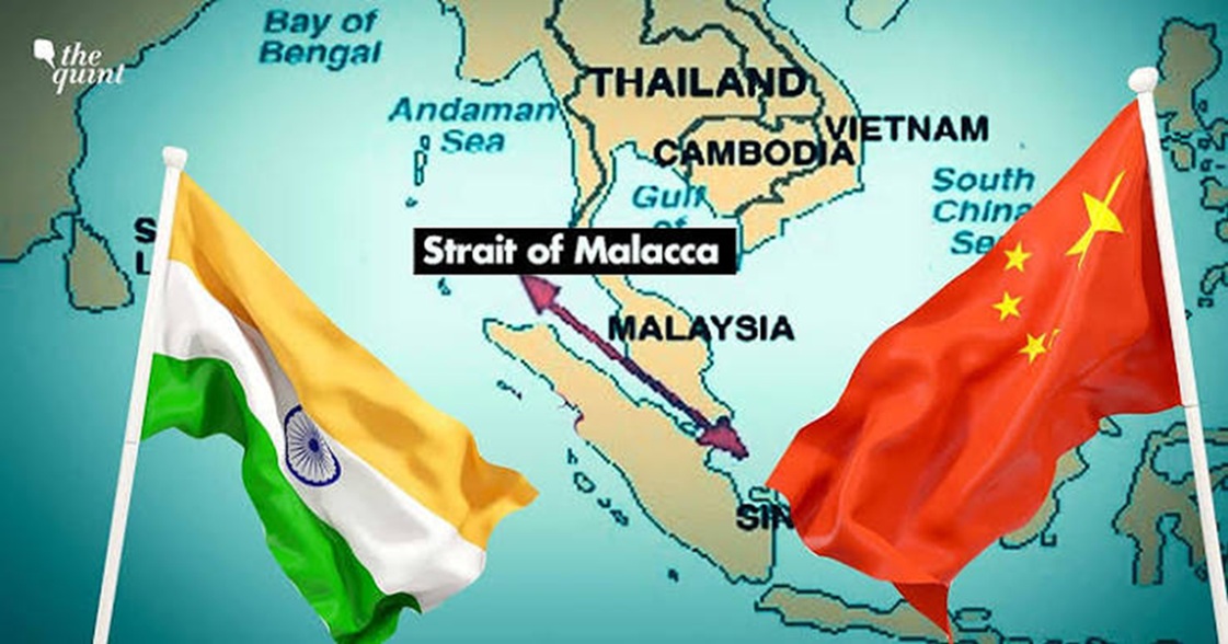
Satellites are playing an important role in enhancing the safety, efficiency and sustainability of sea-going vessels. They have revolutionized maritime operations by enhancing navigation, communication and security, thus playing a crucial role in enhancing maritime surveillance. Satellite-enabled last-mile connectivity coupled with cognitive technologies has triggered the next-generation applications and systems to support seafarers. Applications span from commercial shipping, fishing, military, scientific missions and enhancing environmental protection. Let us explore how exactly the maritime and blue economy benefits from satellite technologies and associated innovations. This research is based on reliable literature available in the public domain.
Maritime Domain Awareness
Surveillance satellites provide persistent monitoring of large maritime areas for enhanced security. These are used for piracy detection, border security and monitoring sensitive sea lanes. Satellites assist in tracking vessels in high-risk areas, detect unusual ship movements and support law enforcement agencies. Cognitive technology and computer vision significantly enhance maritime domain awareness by improving situational awareness and decision-making processes. Satellites fitted with SAR / ISAR sensors can resolve targets of relevance effectively to identify potential threats even in adverse weather conditions. By integrating AI and ML with user-centric design principles and effective data fusion, maritime authorities can have effective monitoring and responses to complex maritime situations. Algorithms are used to analyse vast amounts of maritime data, satellite imagery, Automatic Identification Systems (AIS) data and other sensor data for identifying patterns, predicting vessel behaviour and detecting anomalies, which is crucial for timely decision-making, threat assessment and real-time monitoring. By leveraging historical data and real-time inputs, cognitive systems can predict potential distress scenarios, such as equipment failures or navigational errors. Satellite technologies can even aid digital twinning to replicate the machinery status of a fleet of ships at the shore station for necessary precautions.
Automatic Identification Systems (AIS)
Satellite-based Automatic Identification System (SAT-AIS) is a crucial advancement in maritime tracking and safety, extending the capabilities of traditional AIS, which is limited to coastal areas. AIS is a ship tracking system used by vessels to broadcast position, course, and speed data. Satellite AIS captures this information from ships even in remote regions beyond the terrestrial AIS range. It enhances global ship tracking and has collision avoidance capabilities. Satellites equipped with AIS receivers collect data on vessel identity, position, course, speed and navigational status. This information is then relayed to ground stations for processing and distribution, providing a comprehensive view of maritime traffic worldwide. With real-time data on vessel movements, companies can reduce fuel consumption and enhance overall fleet performance. Satellites can be used for search and rescue operations, detecting emergency beacons and initiating rescue efforts for stranded ships and individuals at sea. Even mobile apps are now available for AIS systems.
Earth Observation and Remote Sensing Satellites
Constellation of Synthetic Aperture Radars mounted on polar satellites can operate in all weather conditions, day and night. The capabilities of space-based optical sensors have increased over the years. They are used for monitoring maritime traffic, detecting oil spills, identifying activities such as illegal fishing or smuggling, sea piracy and even rescue operations at sea. Optical sensor satellites can provide high-resolution imagery used for environmental monitoring, oceanography and tracking of ships and marine activities during day hours. Applications include monitoring coral reefs, detecting illegal dumping and even studying coastal erosion. Satellites can even do a certain amount of data processing and analysis before beaming back to earth.
Weather and Climate Monitoring Satellites
Both geostationary and polar-orbiting satellites provide weather forecasting, storm tracking and climate monitoring. This information helps mariners avoid dangerous weather conditions such as hurricanes, typhoons, and cyclones. Dedicated oceanographic satellites monitor currents, wave heights and ocean circulation patterns, providing critical data for navigation and operational planning. Satellite-based weather monitoring systems provide real-time data on wind speed, direction, atmospheric pressure, humidity, surface temperature, storm tracking, and wave heights, helping shipping lines plan routes, reduce fuel consumption and ensure safety at sea. Satellite-based Global Maritime Distress and Safety System (GMDSS) utilizes satellites such as Inmarsat and Cospas-Sarsat to provide reliable distress and safety communications. It helps render distress alerts, coordinate search and rescue operations, and broadcast maritime safety warnings.
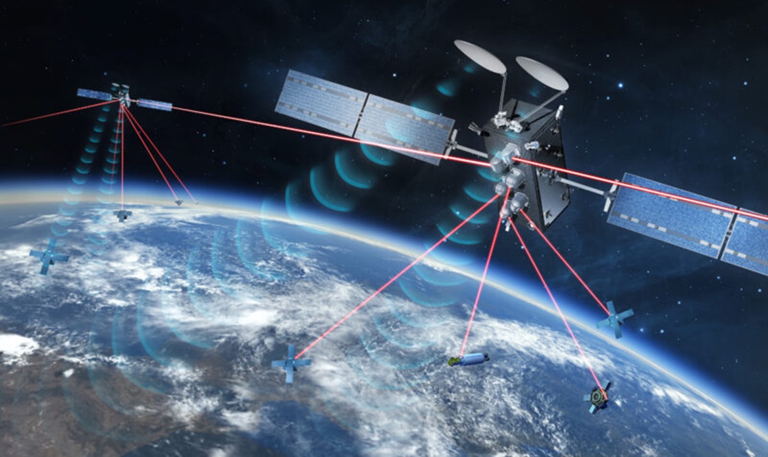
Maritime Satellite and Broadband Communications
Choosing the best satellite connectivity for maritime applications depends on specific operational needs, such as bandwidth requirements, coverage area, and cybersecurity considerations.
- Intelsat
Intelsat provides a comprehensive suite of maritime connectivity solutions designed to support high-bandwidth applications. Their services facilitate seamless communication between vessels and onshore operations, enhancing crew welfare and operational efficiency. Intelsat’s network is noted for its low latency and high reliability, making it suitable for real-time applications such as predictive maintenance and operational data management. They also emphasize cybersecurity, ensuring secure end-to-end communication for maritime operations. Intelsat FlexMaritime is a high-throughput satellite (HTS) service that delivers reliable and secure connectivity speeds exceeding 20 Mbps. Featuring both L-band (ELERA) narrowband and Ka-band (Global Xpress) high-speed broadband payloads with 56 GEO satellites.
- Inmarsat
Inmarsat has been a leader in maritime satellite services for over 40 years, offering global voice and data services to over 1,60,000 vessels worldwide, that enhance crew welfare and operational capabilities. Their solutions are geared towards supporting the digital transformation of the maritime industry, providing essential connectivity for various vessel types, from container ships to offshore support vessels. Inmarsat’s network is designed to support critical business operations and improve safety at sea, making it a trusted choice for many shipping companies. Inmarsat’s maritime connectivity solutions, particularly Fleet Xpress and Fleet Reach are designed to meet the evolving demands of the maritime industry. They feature both L-band (ELERA) narrowband and Ka-band (Global Xpress) high-speed broadband payloads. Inmarsat owns and operates 14 satellites in geostationary orbit 35,786 km above the Earth.
- Eutelsat
Eutelsat offers multi-orbit satellite connectivity solutions that combine both GEO and LEO satellite technologies. This approach provides extensive coverage and flexibility, catering to the diverse needs of maritime users. Their Eutelsat ADVANCE service allows for scalable connectivity solutions that can be adjusted based on demand, making it suitable for various maritime applications. Eutelsat emphasizes secure, reliable connectivity, which is essential for modern maritime operations. Their maritime solutions provide global access using Ku-band VSATs. They offer a range of connectivity packages from 256 Kbps download / 128 Kbps upload to 2 Mbps download / 512 Kbps upload, with Committed Information Rates (CIR) from 64 Kbps up to 1 Mbit/s. Eutelsat operates a fleet of 36 geostationary satellites (GEO) and has recently merged with OneWeb to enhance its capabilities with a constellation of over 600 low Earth orbit (LEO) satellites.
- Starlink
Starlink, operated by SpaceX, provides high-speed, low-latency internet connectivity for maritime applications. Their service is particularly beneficial for vessels operating in remote areas, as it allows for seamless communication and data transfer. Starlink’s system is easy to install and integrates well with existing onboard networks, making it a practical choice for enhancing crew communication and operational efficiency. It covers over 70 countries with a Low latency of under 80 ms and speeds up to 220 Mbps download and 40 Mbps upload. It is very easy to install, user friendly and relatively cheap compared to others. It has around 5000+ satellites in LEO orbit.
Smart Supply Chains – Container and Cargo Movements
Sensors can track parameters such as temperature, humidity, pressure, and weight of goods during transport, ensuring the integrity and safety of the cargo, particularly for perishable or sensitive items. Satellite-based supply chain management is revolutionizing maritime logistics by providing robust connectivity and data analytics capabilities. SCM can increase efficiency, improve visibility, cost reduction by optimizing routes and reducing delays, companies can ever lower fuel costs and improve overall profitability. It helps to enhance decision-making by accessing accurate and real-time data. Satellite data helps synchronize multi-modal transport such as shipping, rail, trucking and air freight by providing real-time updates on ship movements and port operations. Dedicated satellite links can establish blockchain-based SCM systems by connecting up untrusted networks and databases belonging to various agencies.
Satellite-Based Vessel Navigation and Automation
GPS (Global Positioning System) and GNSS (Global Navigation Satellite System) provide accurate positioning, navigation, and timing information for vessels, enabling safer navigation and more efficient route planning. The Navigation Innovation and Support Programme (NAVISP) can improve maritime operations which would provide precise positioning, navigation and timing data for safe and efficient docking. Projects like the Grimaldi Satellite Assisted Berthing (GSAB) are developing satellite-based guidance systems for docking manoeuvres that could help large ships dock more safely and efficiently.
Autonomous ships and unmanned surface vehicles (USVs) use satellite links for remote control and data exchange. This includes navigation, obstacle detection and mission planning. Enabling technologies that can facilitate vessel automation are AI and ML-based remote navigation and control, satellite connectivity, integration to weather and oceanographic data cloud, collision avoidance systems, emergency response and self-protection systems, fleet management, onboard sensor and data integration and MDA.
Conclusion
Satellite technologies, combined with advanced data analytics and AI are revolutionizing maritime domain awareness and enabling more effective governance of the oceans. These technologies collectively enhance maritime safety, efficiency and sustainability, making them indispensable for modern maritime operations. Space-based innovations can transform the maritime sector making it more sustainable and efficient, benefiting mankind in the coming decade.
Title image courtesy: Via Satellite
Disclaimer: The views and opinions expressed by the author do not necessarily reflect the views of the Government of India and Defence Research and Studies